Table of Contents
To show colours on a map, user need to choose a set of data and a colouring algorithm to describe how to convert the data into colours for display. The simplest source of data is the .dbf file that accompanies the .shp file. This contains the name of each region on the map, and often contains useful information such as area which can be used as sample data for testing. In order to use the .dbf, .dbf file will be to be converted to a .ds file.
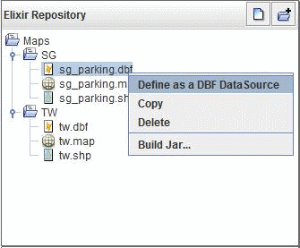
Select a .dbf file and right-click to select
Define as a DBF
					DataSource
, as seen in Figure 3.1, “Define DBF DataSource”.A default .ds file will be created
Click on the
Load Databutton to view data.
